_______________________________________________________________________________________________________
SOUTHERN CALIFORNIA SURF FORECAST UPDATED 4-29-16
_______________________________________________________________________________________________________
If you are having problems getting the streams please try using the “Chrome Browser”. Android users that are having problems will need to download the “Puffin Browser”. Click here for troubleshooting tips! Or feel free to email us for technical support contact us
_______________________________________________________________________________________________________
I’m not trying to frighten anyone, just relaying news through the grape vine as it becomes available.
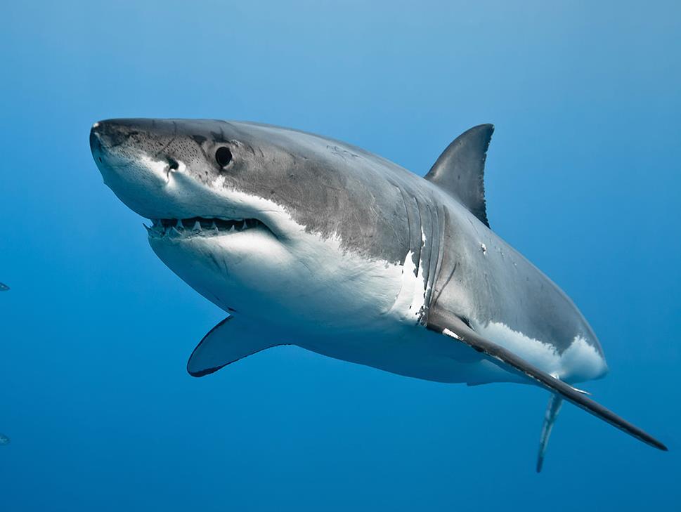
There was an estimated 10 foot shark in the line up at El Porto yesterday. Wagner Abreu, who has seen many sharks in and around the Manhattan Beach area had the shark surface near him on 2 occasions and quickly exited the water. Others claimed to see the large dorsal fin from the safety of the parking lot.
_______________________________________________________________________________________________________
For Saturday we should see some fresh SW swell start to fill in throughout the day and mix with the NW wind swell. The dominant energy will be coming in from a 185-195 degree angle with powerful 18-20 second intervals. The exposed South facing breaks should see shoulder to head high sets by days end and the NW wind swell should contribute shoulder high + swell.
Saturday
2016-04-30 Sat 01:57 AM Moonrise
2016-04-30 Sat 03:43 AM 4.09 feet High Tide
2016-04-30 Sat 06:05 AM Sunrise
2016-04-30 Sat 11:09 AM 0.38 feet Low Tide
2016-04-30 Sat 01:06 PM Moonset
2016-04-30 Sat 06:10 PM 3.91 feet High Tide
2016-04-30 Sat 07:37 PM Sunset
2016-04-30 Sat 11:33 PM 2.29 feet Low Tide
The conditions should be okay with 4-9 MPH breezes out of the E/SE/SSE until 11AM and 9-13 MPH out of the West until sundown. The air temp tops out at 66 degrees.
_______________________________________________________________________________________________________
Sunday should be pretty good for the S/SW facing breaks and will be more consistent as the intervals on the SW swell dip to 16-18 seconds. The top spots should see shoulder to head high sets and the NW wind swell will continue on in the background! Top spots in the OC and San O’ areas will see larger OH sets. It’s a deep water, (3.2 feet at 16-18 seconds), so it will definitely have a little bit of pop to it!
Sunday
2016-05-01 Sun 02:39 AM Moonrise
2016-05-01 Sun 05:11 AM 4.17 feet High Tide
2016-05-01 Sun 06:04 AM Sunrise
2016-05-01 Sun 12:02 PM 0.26 feet Low Tide
2016-05-01 Sun 02:09 PM Moonset
2016-05-01 Sun 06:44 PM 4.41 feet High Tide
2016-05-01 Sun 07:38 PM Sunset
The conditions look great for spots that like a little South in the wind equation. We’ll see SE/SSE breezes at 8-15 MPH until noon and up to 10-15 MPH out of the South West in the afternoon. There’s a 10% chance of rain and the air temp tops out at 67 degrees.
_______________________________________________________________________________________________________
Monday should be a little smaller as both the wind swell and South West swell back down. The Southerly energy will be dominant, but the size will drop and the wait between sets will increase. This fade will continue into Tuesday, but if you’re patient, there should be some fun sets rolling through.
Monday
2016-05-02 Mon 12:35 AM 1.59 feet Low Tide
2016-05-02 Mon 03:20 AM Moonrise
2016-05-02 Mon 06:03 AM Sunrise
2016-05-02 Mon 06:22 AM 4.38 feet High Tide
2016-05-02 Mon 12:47 PM 0.18 feet Low Tide
2016-05-02 Mon 03:14 PM Moonset
2016-05-02 Mon 07:17 PM 4.95 feet High Tide
2016-05-02 Mon 07:39 PM Sunset
The conditions should be okay with variable breezes at 2-6 MPH until noon and then 9-12 MPH out of the West in the afternoon. The air temp tops out at 69 degrees.
_______________________________________________________________________________________________________
Tuesday will be a little smaller with only the dying SW energy on the menu. The better South facing beaches will see waist high plus sets in the morning and then that swell will be gurneyed off to the hospice in the afternoon.
Tuesday
2016-05-03 Tue 01:26 AM 0.82 feet Low Tide
2016-05-03 Tue 04:00 AM Moonrise
2016-05-03 Tue 06:02 AM Sunrise
2016-05-03 Tue 07:22 AM 4.59 feet High Tide
2016-05-03 Tue 01:29 PM 0.17 feet Low Tide
2016-05-03 Tue 04:21 PM Moonset
2016-05-03 Tue 07:39 PM Sunset
2016-05-03 Tue 07:51 PM 5.51 feet High Tide
The conditions look poor to fair on todays wind models with onshore breezes at 2-6 MPH until 10AM and then 9-14 MPH out of the West in the afternoon. The air temp tops out at 71 degrees.
_______________________________________________________________________________________________________
Water Temps: are as follows – Malibu 55, Santa Monica 59, Hermosa 60, Huntington 59 & Newport 60 degrees.
_______________________________________________________________________________________________________
I’ll be back on Sunday with a peek into next week!
______________________________________________________________________________________________________

