_______________________________________________________________________________________________________
SOUTHERN CALIFORNIA SURF FORECAST UPDATED on 6-6-2019
______________________________________________________________________________________________________
Be sure to tune into our Swellmagnet.com Facebook page – We will be posting current events, interesting articles, the latest surf videos and our new on air personality “The C-Dog” with some live surf reports and hilarious impromptu beach interviews! Swellmagnet Facebook
______________________________________________________________________________________________________
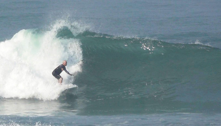
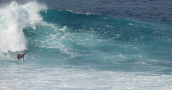
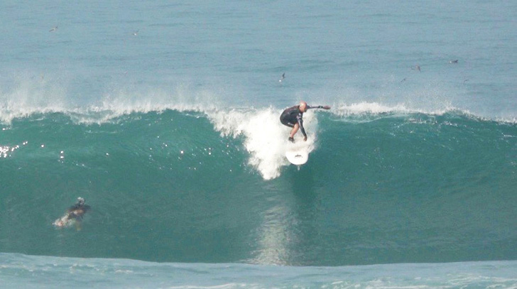
Here’s a couple shots from Mainland Mexico last week. This isn’t even one of the “Big” days. The the surf was DOH to TOH for 8 consecutive days. It was actually rather frightening, but the adrenaline glands are finely lubed up and everybody came home safe and sound!
______________________________________________________________________________________________________
For Friday morning that SW energy will continue its slow, methodical fade as the waves get smaller and less consistent. The better South facing beaches should see waist to maybe chest high sets in the AM. The angle will be from 190-200 degrees with 14 second intervals.
We’ll also see some smallish knee to waist high NW wind swell from 310 degrees with 8-10 second intervals.
The better South facing breaks will be the best bet, but the size and power will continue to wane.
Am early minus tide does us no favors – 07:33 AM -0.89 feet Low Tide
Friday
2019-06-07 Fri 12:05 AM 6.18 feet High Tide
2019-06-07 Fri 05:40 AM Sunrise
2019-06-07 Fri 07:33 AM -0.89 feet Low Tide
2019-06-07 Fri 09:59 AM Moonrise
2019-06-07 Fri 02:28 PM 4.00 feet High Tide
2019-06-07 Fri 07:00 PM 2.64 feet Low Tide
2019-06-07 Fri 07:54 PM Sunset
The conditions look okay with light, 2-4 MPH onshore winds until 10:00AM and then 6-10 MPH out of the West in the afternoon. The air temp tops out 67 degrees and there’s a 10% chance of rain.
______________________________________________________________________________________________________
For Saturday morning we’ll dip into the waist high zone pretty much everywhere. The SW energy will be on its last leg and the NW wind swell will be quite unimpressive.
* 08:29 AM -0.48 feet Low Tide
Saturday
2019-06-08 Sat 12:14 AM Moonset
2019-06-08 Sat 12:56 AM 5.39 feet High Tide
2019-06-08 Sat 05:42 AM Sunrise
2019-06-08 Sat 08:29 AM -0.48 feet Low Tide
2019-06-08 Sat 11:09 AM Moonrise
2019-06-08 Sat 03:40 PM 3.98 feet High Tide
2019-06-08 Sat 08:03 PM Sunset
2019-06-08 Sat 08:25 PM 2.72 feet Low Tide
The conditions look okay in the morning with variable breezes out of the West in the 1-5 MPH zone until noon and then 8-10 MPH out of the West in the afternoon. The air temp tops out at 71 degrees and there’s a 10% chance of rain.
______________________________________________________________________________________________________
For Sunday morning we will see another burst of steeply angled South swell. This fresh energy will start off in the waist high range in the AM and get a little bigger and more consistent and the day wears on. The angle will be much steeper than the last swell, swinging in from a 175-180 degree angle with 16 second intervals.
Sunday
2019-06-09 Sun 12:56 AM Moonset
2019-06-09 Sun 02:07 AM 4.84 feet High Tide
2019-06-09 Sun 05:42 AM Sunrise
2019-06-09 Sun 09:29 AM -0.16 feet Low Tide
2019-06-09 Sun 12:17 PM Moonrise
2019-06-09 Sun 04:38 PM 4.35 feet High Tide
2019-06-09 Sun 08:04 PM Sunset
2019-06-09 Sun 10:05 PM 2.42 feet Low Tide
2019-06-09 Sun 11:00 PM First Quarter
The conditions look tolerable with S/SW winds in the 2-6 MPH zone until noon and 9-11 MPH in the afternoon. The air temp tops out at 65 degrees and there’s a 10% chance of rain.
______________________________________________________________________________________________________
For Monday morning that steep South swell should peak and dish up waist to chest high sets to only the most exposed South facing breaks. The OC and San O’ areas look like the best bet but it looks to be pretty lackluster!
Monday
2019-06-10 Mon 01:34 AM Moonset
2019-06-10 Mon 03:31 AM 4.34 feet High Tide
2019-06-10 Mon 05:42 AM Sunrise
2019-06-10 Mon 10:28 AM 0.17 feet Low Tide
2019-06-10 Mon 01:23 PM Moonrise
2019-06-10 Mon 05:28 PM 4.79 feet High Tide
2019-06-10 Mon 08:04 PM Sunset
2019-06-10 Mon 11:33 PM 1.82 feet Low Tide
The conditions look decent with onshore winds in the 1-3 MPH zone until 10:00AM and 8-12 MPH in the afternoon. The air temp tops out at 74 degrees.
______________________________________________________________________________________________________
For Tuesday morning that SW energy will continue to move in from a 175-180 degree angle with 13-14 second intervals and deliver waist high + sets for the best South facing breaks.
Tuesday
2019-06-11 Tue 02:09 AM Moonset
2019-06-11 Tue 05:01 AM 4.01 feet High Tide
2019-06-11 Tue 05:42 AM Sunrise
2019-06-11 Tue 11:22 AM 0.51 feet Low Tide
2019-06-11 Tue 02:28 PM Moonrise
2019-06-11 Tue 06:12 PM 5.25 feet High Tide
2019-06-11 Tue 08:05 PM Sunset
The conditions should be okay for the early shift with onshore breezes in the 2-4 MPH zone until 11AM and 7-9 MPH in out of the SW in the afternoon. The air temp tops out at 74 degrees and there’s a 10% chance of rain.
______________________________________________________________________________________________________
For Wednesday morning we’ll see that Southerly energy dip down into the knee to waist high range for the exposed South facing breaks…. yawn!
Wednesday
2019-06-12 Wed 12:42 AM 1.09 feet Low Tide
2019-06-12 Wed 02:43 AM Moonset
2019-06-12 Wed 05:42 AM Sunrise
2019-06-12 Wed 06:22 AM 3.86 feet High Tide
2019-06-12 Wed 12:12 PM 0.84 feet Low Tide
2019-06-12 Wed 03:33 PM Moonrise
2019-06-12 Wed 06:52 PM 5.68 feet High Tide
2019-06-12 Wed 08:05 PM Sunset
The conditions look okay early in the morning with S/SW breezes in the 1-4 MPH zone until 10:00 AM and then 6-10 MPH out of the West in the afternoon. The air temp tops out 72 degrees.
______________________________________________________________________________________________________
Water temps are as follows, (day of 4CAST update) and are as follows: Malibu 60 Santa Monica 60 South Bay 60, Huntington 61, Newport 60.
______________________________________________________________________________________________________
The next 4Cast will be updated on Sunday.
______________________________________________________________________________________________________
ABOUT THE SWELLMAGNET FORECAST – One of the most exciting–and yet most challenging–aspects of surfing is the sheer variety of waves and weather conditions that affect the entire surfing experience. Any surfer who is interested in going beyond the most basic level of surfing will have to develop the ability to interpret waves and environmental conditions. This is important for ensuring both a safe and enjoyable experience.
The main difficulty lies in predicting how exactly the ocean and the environment will behave at any given time. One day, you could be riding four-footers all day and the next, you might be facing a glasslike surface with nary a ripple. Conditions can change drastically from day-to-day and even within the space of a couple of hours. To avoid wasted time and unproductive trips to the surf, it is essential to have access to reliable information on surf conditions.
Sites such as Swellmagnet.com offer up-to-the-minute surf reports that are essential to all California surfers. The company relies on an extensive network of surf cams and surf experts in order to monitor the precise surf conditions on any given day. All information is collated and analyzed by qualified surf specialists, with the resulting data being provided to the public via the Swellmagnet site.
Swellmagnet provides some of the best surf reports in the industry, with accurate and verifiable results gathered via an innovative system of surf condition monitors and detectors. Expert surf analysis is provided by the company’s team of highly experienced specialists, each with long years of experience monitoring and actually experiencing the full range of surf conditions. This combination of state-of-the-art technology and extensive practical experience ensures the highest quality and most accurate surf reports available.
For surfers who wish to take full advantage of the best that the California coast has to offer, the services provided by Swellmagnet are essential.


