_______________________________________________________________________________________________________
SOUTHERN CALIFORNIA SURF FORECAST UPDATED on 1-18-19
_______________________________________________________________________________________________________
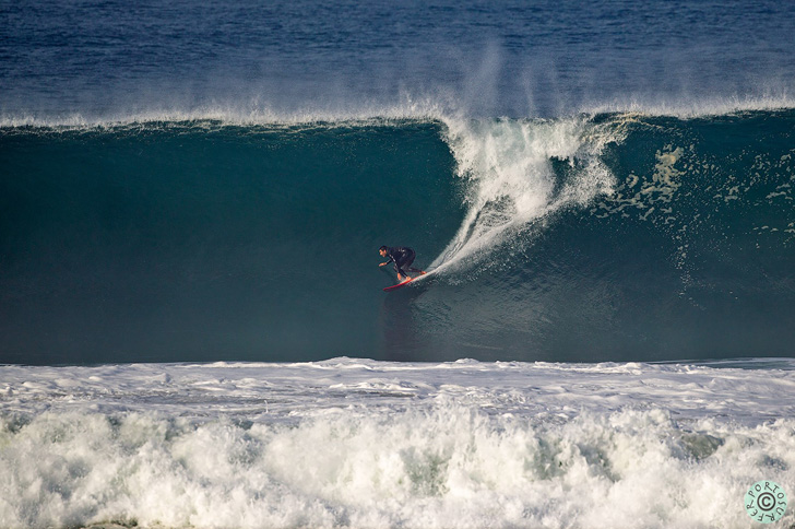
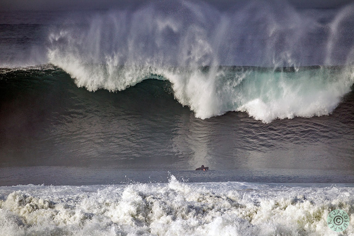
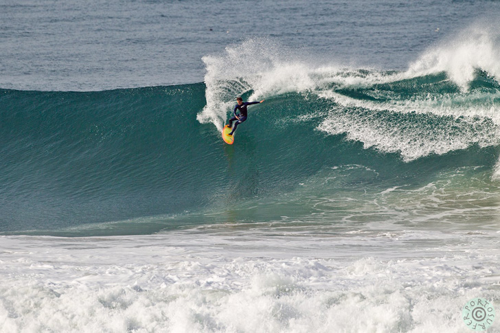
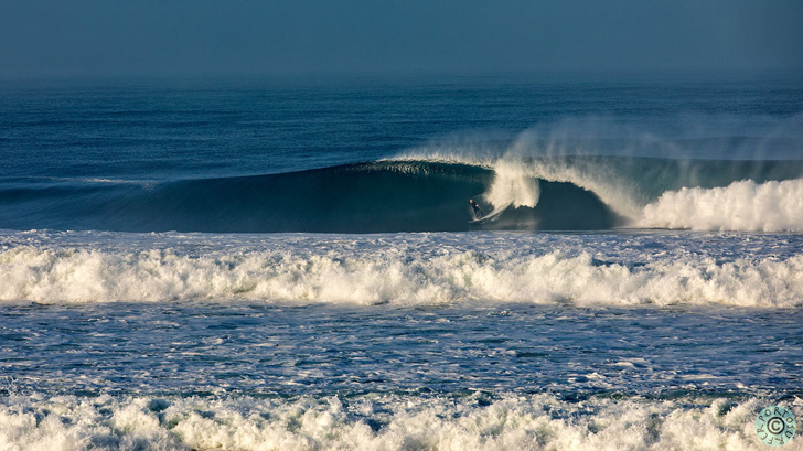
These pics are from this morning 1-18-19 – Not “Big Wednesday”… I’ll call it “Good Friday”
Shots courtesy of Lucio Gomes – portosurferphotography.com
_______________________________________________________________________________________________________
For Friday morning we’ll see the peak of that new swell and the top West facing beaches will dish up OH to DOH to possibly TOH sets. The swell angle will be 290-300 degrees with 16-17 second intervals and all of the numbers are reminiscent of that last Big Wednesday swell. All you heavy hitters out there should get a good night of sleep. If things clean up then this might be “Good Friday” and possibly deliver the biggest waves of the season. Let me preface this claim with the fact that this storm was generated in close proximity to So Cal and will hit fast and hard and creep out quickly through a 2 day period. Be there or be square!
Facts: 7.1 feet (deep water swell), with 16-18 second intervals from a 290-300 degree angle.
Lots of water will be moving around so be careful out there!
Friday
2019-01-18 Fri 12:03 AM 2.00 feet Low Tide
2019-01-18 Fri 04:19 AM Moonset
2019-01-18 Fri 06:28 AM 6.19 feet High Tide
2019-01-18 Fri 06:58 AM Sunrise
2019-01-18 Fri 01:48 PM -0.96 feet Low Tide
2019-01-18 Fri 02:50 PM Moonrise
2019-01-18 Fri 05:10 PM Sunset
2019-01-18 Fri 08:16 PM 3.72 feet High Tide
TIDAL ALERT: 06:28 AM 6.19 feet High Tide
The conditions should be okay with variable winds at 1-5 all day long, (leaning toward offshore in the early AM), there’s a 10% chance of showers and the air temp tops out at 64 degrees.
Beware of the Urban Runoff – It is advised to stay out of the water for 72 hours following any measurable rainfall.
______________________________________________________________________________________________________
For Saturday morning the surf should back down into the head high to OH zone early, (for the best West facing breaks), as this swell fades fast. The energy will continue to come down the line from a 295-300 degree angle with 13-14 second intervals and fade out quickly through the day.
Saturday
2019-01-19 Sat 12:52 AM 1.89 feet Low Tide
2019-01-19 Sat 05:25 AM Moonset
2019-01-19 Sat 06:58 AM Sunrise
2019-01-19 Sat 07:12 AM 6.63 feet High Tide
2019-01-19 Sat 02:29 PM -1.45 feet Low Tide
2019-01-19 Sat 03:50 PM Moonrise
2019-01-19 Sat 05:11 PM Sunset
2019-01-19 Sat 08:57 PM 3.95 feet High Tide
TIDAL ALERT: 07:12 AM 6.63 feet High Tide
The conditions look great in the AM with 3-8 MPH breezes out of the NE/NNE until noon, (slightly stronger below passes and canyons), and the air temp jumps up to 71 degrees.
Beware of the Urban Runoff – It is advised to stay out of the water for 72 hours following any measurable rainfall.
______________________________________________________________________________________________________
For Sunday morning the wave size will calm down considerably but the better West facing breaks see sets in the head high to OH zone. The swell angle will be a 285-295 degree angle with 13-14 second intervals.
Sunday
2019-01-20 Sun 01:40 AM 1.74 feet Low Tide
2019-01-20 Sun 06:28 AM Moonset
2019-01-20 Sun 06:57 AM Sunrise
2019-01-20 Sun 07:57 AM 6.92 feet High Tide
2019-01-20 Sun 03:10 PM -1.73 feet Low Tide
2019-01-20 Sun 04:56 PM Moonrise
2019-01-20 Sun 05:12 PM Sunset
2019-01-20 Sun 09:17 PM Full Moon
2019-01-20 Sun 09:38 PM 4.14 feet High Tide
TIDAL ALERT: 07:57 AM 6.92 feet High Tide
The conditions look ehhh… with light breezes out of the S/SW at 2-5 MPH until noon and 5-11 MPH out of the West in the afternoon. The air temp dips to 66 degrees.
______________________________________________________________________________________________________
For Monday morning we’ll see a little dip in size but there will still be waves in the shoulder to Head High range for the top West facing breaks. It will be some short interval wind swell with 10-11 second intervals from a steep 305-310 degree angle.
Monday
2019-01-21 Mon 02:29 AM 1.59 feet Low Tide
2019-01-21 Mon 06:57 AM Sunrise
2019-01-21 Mon 07:25 AM Moonset
2019-01-21 Mon 08:43 AM 7.00 feet High Tide
2019-01-21 Mon 03:52 PM -1.78 feet Low Tide
2019-01-21 Mon 05:13 PM Sunset
2019-01-21 Mon 06:07 PM Moonrise
2019-01-21 Mon 10:20 PM 4.29 feet High Tide
TIDAL ALERT: 08:43 AM 7.00 feet High Tide
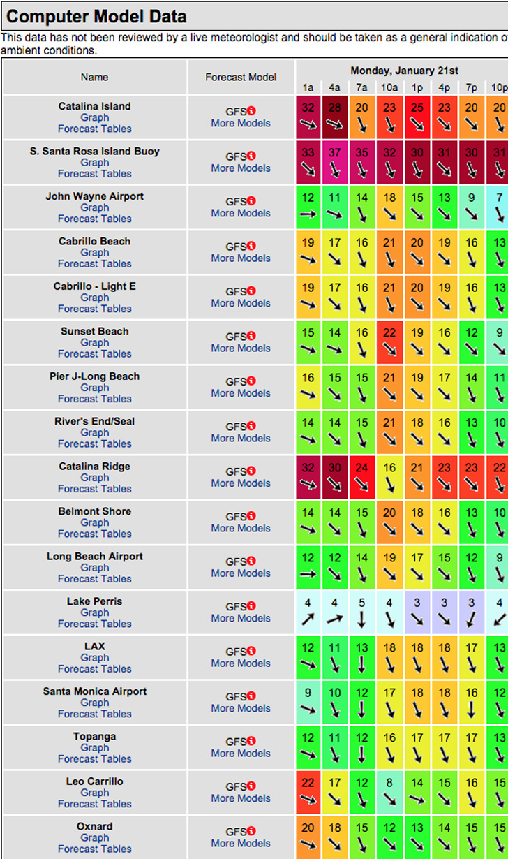
The conditions look a bit chaotic in a bad way… see swell model below. The air temp tops out at 65 degrees.
______________________________________________________________________________________________________
For Tuesday morning we’ll see the smallest waves we’ve seen in some time but it will be rideable if you can work around the high tide. Surf: Wind swell from a 305-310 degree angle and 8-10 second intervals.
Tuesday
2019-01-22 Tue 03:18 AM 1.49 feet Low Tide
2019-01-22 Tue 06:56 AM Sunrise
2019-01-22 Tue 08:15 AM Moonset
2019-01-22 Tue 09:29 AM 6.82 feet High Tide
2019-01-22 Tue 04:34 PM -1.59 feet Low Tide
2019-01-22 Tue 05:14 PM Sunset
2019-01-22 Tue 07:19 PM Moonrise
2019-01-22 Tue 11:03 PM 4.41 feet High Tide
TIDAL ALERT: 09:29 AM 6.82 feet High Tide
The conditions look fantastic with variable breezes out of the NE/NNE in the 6-11 MPH zone all day long, (stronger below the passes and canyons). The air temp tops out at 67 degrees.
______________________________________________________________________________________________________
Water temps are as follows, (day of 4CAST update) and are as follows: Malibu 59 Santa Monica 60 South Bay 59, Huntington 57, Newport 60.
______________________________________________________________________________________________________
The next 4CAST will be posted on Sunday!
______________________________________________________________________________________________________
ABOUT THE SWELLMAGNET FORECAST – One of the most exciting–and yet most challenging–aspects of surfing is the sheer variety of waves and weather conditions that affect the entire surfing experience. Any surfer who is interested in going beyond the most basic level of surfing will have to develop the ability to interpret waves and environmental conditions. This is important for ensuring both a safe and enjoyable experience.
The main difficulty lies in predicting how exactly the ocean and the environment will behave at any given time. One day, you could be riding four-footers all day and the next, you might be facing a glasslike surface with nary a ripple. Conditions can change drastically from day-to-day and even within the space of a couple of hours. To avoid wasted time and unproductive trips to the surf, it is essential to have access to reliable information on surf conditions.
Sites such as Swellmagnet.com offer up-to-the-minute surf reports that are essential to all California surfers. The company relies on an extensive network of surf cams and surf experts in order to monitor the precise surf conditions on any given day. All information is collated and analyzed by qualified surf specialists, with the resulting data being provided to the public via the Swellmagnet site.
Swellmagnet provides some of the best surf reports in the industry, with accurate and verifiable results gathered via an innovative system of surf condition monitors and detectors. Expert surf analysis is provided by the company’s team of highly experienced specialists, each with long years of experience monitoring and actually experiencing the full range of surf conditions. This combination of state-of-the-art technology and extensive practical experience ensures the highest quality and most accurate surf reports available.
For surfers who wish to take full advantage of the best that the California coast has to offer, the services provided by Swellmagnet are essential.

