______________________________________________________________________________
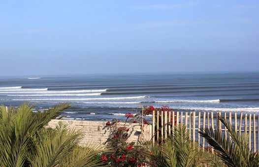
[easyrotator]erc_74_1355541793[/easyrotator]Today’s Slideshow is courtesy of Brian McStotts
– Check out more pics
______________________________________________________________________________
SOUTHERN CALIFORNIA SURF FORECAST UPDATED 10-14-14
______________________________________________________________________________

Our review, complete with a narrated video tour, of the Chicama Surf Resort in Peru is hot off the press! Check it out!
______________________________________________________________________________
SHARK UPDATE To see the latest shark updates follow us on Facebook Check it out!
______________________________________________________________________________
HURRICANE WATCH October 14th, 2014 – The East Pacific Basin remains much quieter than we have seen through much of the season, but there is still one area we are monitoring for potential development that is currently a couple hundred miles off the coast of Guatemala and southeastern Mexico. As this cluster of showers and thunderstorms shifts off to the northwest over the next few days, there could be some gradual strengthening and further organization of this area.
Farther west toward Hawaii in the Central Pacific Basin, Tropical Storm Ana is a bit under 900 miles east-southeast of the Big Island. Ana will track to the west-northwest over the next few days and could be close to the Big Island this weekend. Water temperatures are relatively warm along the forecast track and in general are at or just above 80 degrees. So there is potential for some strengthening, and it has a chance to become a hurricane by Thursday. The potential is there for substantial impacts on Hawaii this weekend, and all those with interests in Hawaii need to monitor the progress of Ana carefully.
The Central Pacific uses four rotating lists of names and the last storm to form in this basin was Wali back in July; that was the last name on the third list.
______________________________________________________________________________
Wednesday morning looks smaller and less consistent, with leftovers from the NW energy in the waist to chest high plus range and sporadic pulses out of the SW. That likely means you’ll just have to wait longer to get a shot at catching a close out!
Wednesday
2014-10-15 Wed 05:27 AM 3.80 feet High Tide
2014-10-15 Wed 06:59 AM Sunrise
2014-10-15 Wed 09:56 AM 3.18 feet Low Tide
2014-10-15 Wed 12:13 PM Last Quarter
2014-10-15 Wed 01:37 PM Moonset
2014-10-15 Wed 03:31 PM 4.32 feet High Tide
2014-10-15 Wed 06:19 PM Sunset
2014-10-15 Wed 11:08 PM 1.02 feet Low Tide
The conditions look iffy again with onshore winds out of the West in the 3-9 MPH range throughout the day. The morning hours look to be the calmest. The air temp remains at 72 degrees.
___________________________________________________________________________
For Thursday morning will be smaller for the AM with knee to waist high + surf most everywhere. There will however be some fresh, steeply angled, NW energy rolling in from a 300-305 degree angle. This should fill in throughout the day with healthy 14 second intervals, and should generate chest high plus sets by late morning.
Thursday
2014-10-16 Thu 12:30 AM Moonrise
2014-10-16 Thu 06:21 AM 4.08 feet High Tide
2014-10-16 Thu 06:59 AM Sunrise
2014-10-16 Thu 11:33 AM 2.89 feet Low Tide
2014-10-16 Thu 02:16 PM Moonset
2014-10-16 Thu 04:59 PM 4.27 feet High Tide
2014-10-16 Thu 06:18 PM Sunset
The conditions should be fair with variable winds in the 1-5 MPH zone until noon and go 6-8 MPH out of the West in the afternoon. The air temp tops out at 70 on the sand.
___________________________________________________________________________
For Friday morning that same swell will remain in play and dish up chest to shoulder high + sets and a few larger waves at the top deep water breaks.
Friday
2014-10-17 Fri 12:04 AM 1.00 feet Low Tide
2014-10-17 Fri 01:23 AM Moonrise
2014-10-17 Fri 06:56 AM 4.35 feet High Tide
2014-10-17 Fri 07:00 AM Sunrise
2014-10-17 Fri 12:32 PM 2.46 feet Low Tide
2014-10-17 Fri 02:53 PM Moonset
2014-10-17 Fri 06:06 PM 4.36 feet High Tide
2014-10-17 Fri 06:17 PM Sunset
The conditions look tolerable with variable Westerly winds in the 1-5 MPH zone until the early afternoon and then those get up to 10-14 MPH out of the West later in the day. The air temp tops out at 71 degrees.
___________________________________________________________________________
For Saturday morning that same swell will continue to crank out chest to shoulder high sets and then very slowly ease up into the afternoon.
Saturday
2014-10-18 Sat 12:45 AM 0.97 feet Low Tide
2014-10-18 Sat 02:16 AM Moonrise
2014-10-18 Sat 07:01 AM Sunrise
2014-10-18 Sat 07:22 AM 4.61 feet High Tide
2014-10-18 Sat 01:13 PM 2.00 feet Low Tide
2014-10-18 Sat 03:26 PM Moonset
2014-10-18 Sat 06:16 PM Sunset
2014-10-18 Sat 06:57 PM 4.50 feet High Tide
The conditions look okay with variable winds in the 2-5 MPH zone until 11AM and then those get up to 9-11 MPH out of the West in the afternoon. The air temp tops out at 72 degrees.
___________________________________________________________________________
For Sunday morning, if the models hold true, we’ll see the NW swell train continue to chug into Southern California waters as more energy comes down the line through the day. It looks like there’s even potential for bigger swell to work it’s way into the picture for Monday as well.
Sunday
2014-10-19 Sun 01:18 AM 0.98 feet Low Tide
2014-10-19 Sun 03:10 AM Moonrise
2014-10-19 Sun 07:02 AM Sunrise
2014-10-19 Sun 07:45 AM 4.87 feet High Tide
2014-10-19 Sun 01:47 PM 1.55 feet Low Tide
2014-10-19 Sun 03:59 PM Moonset
2014-10-19 Sun 06:14 PM Sunset
2014-10-19 Sun 07:38 PM 4.61 feet High Tide
The conditions look okay with variable winds in the 2-4 MPH zone until 11AM and then those climb up to 9-11 MPH out of the West in the afternoon. The air temp holds steady at 72 degrees.
___________________________________________________________________________
The current water temps Newport 70 degrees, Huntington 70 degrees, the South Bay showed as 71 degrees, Santa Monica 71 degrees and Malibu 70 degrees.
______________________________________________________________________________
I’ll be back on Wednesday with the latest scoop!
______________________________________________________________________________
