______________________________________________________________________________
[easyrotator]erc_24_1400602065[/easyrotator]Today’s Slideshow is courtesy of Brian McStotts – Check out more pics
______________________________________________________________________________
SOUTHERN CALIFORNIA SURF FORECAST UPDATED 10-12-14
______________________________________________________________________________
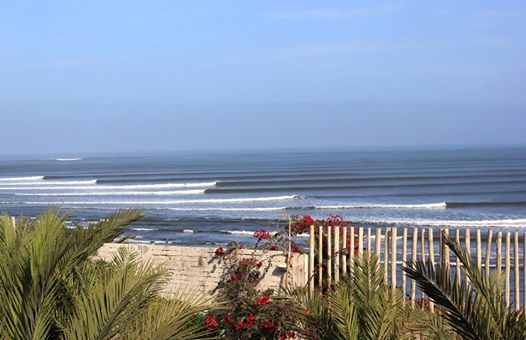
 Our review, complete with a narrated video tour, of the Chicama Surf Resort in Peru is hot off the press! Check it out!
______________________________________________________________________________
SHARK UPDATE To see the latest shark updates follow us on Facebook Check it out!
______________________________________________________________________________
HURRICANE WATCH October 12th, 2014 – An area of disorganized thunderstorms located near the coast of Central America will slowly drift northwestward and remain in close proximity to land over the next day or two. Due to the proximity to land, organized development is unlikely. Regardless of development, heavy rain, flash flooding and mudslides will threaten portions of western Nicaragua, El Salvador, Honduras and Guatemala over the next several days.
Well to the west, another area of disturbed weather about 1,500 miles to the east-southeast of the Big Island of Hawaii will move into a more favorable environment for development over the next several days. Interests in Hawaii should monitor the progress of this tropical wave over the next week.
Elsewhere across the eastern Pacific Basin, no tropical development is expected over the next 24-48 hours.
______________________________________________________________________________
By Monday morning we’ll see that long interval NW swell peak with chest to head high plus sets at most West facing breaks and larger overhead waves at the top deep water beaches.
We’ll continue to see that small, but long interval energy out of the SW from a liberal 220-225 degrees.
The tides look reasonable enough and with another high pressure system in place the conditions should be pretty good all day.
Monday
2014-10-13 Mon 02:10 AM 3.69 feet High Tide
2014-10-13 Mon 06:40 AM 2.75 feet Low Tide
2014-10-13 Mon 06:57 AM Sunrise
2014-10-13 Mon 12:06 PM Moonset
2014-10-13 Mon 12:56 PM 5.09 feet High Tide
2014-10-13 Mon 06:22 PM Sunset
2014-10-13 Mon 08:35 PM 0.78 feet Low Tide
2014-10-13 Mon 10:45 PM Moonrise
The conditions should be good with variable winds in the 1-4 MPH zone until the early afternoon and then those only get up to 6-8 MPH out of the West in the afternoon. The air temp remains 78 degrees.
___________________________________________________________________________
For Tuesday morning that same swell will remain strong through the morning with chest to shoulder high sets and then very slowly ease up into the afternoon.
We’ll continue to see that small, but long interval energy out of the SW from a liberal 220-225 degrees.
Once again, all the elements look favorable but the sand bars will remain a question mark until we see some more solid swell.
Tuesday
2014-10-14 Tue 03:52 AM 3.61 feet High Tide
2014-10-14 Tue 06:58 AM Sunrise
2014-10-14 Tue 07:56 AM 3.11 feet Low Tide
2014-10-14 Tue 12:54 PM Moonset
2014-10-14 Tue 02:01 PM 4.62 feet High Tide
2014-10-14 Tue 06:20 PM Sunset
2014-10-14 Tue 09:55 PM 0.98 feet Low Tide
2014-10-14 Tue 11:37 PM Moonrise
The conditions look okay with variable winds in the 1-3 MPH zone until the early afternoon and then those only get up to 6-9 MPH out of the West in the afternoon. The air temp dips to 72 degrees.
___________________________________________________________________________
Wednesday morning looks smaller with leftovers from the NW energy in the waist high plus range and sporadic pulses out of the SW.
Wednesday
2014-10-15 Wed 05:27 AM 3.80 feet High Tide
2014-10-15 Wed 06:59 AM Sunrise
2014-10-15 Wed 09:56 AM 3.18 feet Low Tide
2014-10-15 Wed 12:13 PM Last Quarter
2014-10-15 Wed 01:37 PM Moonset
2014-10-15 Wed 03:31 PM 4.32 feet High Tide
2014-10-15 Wed 06:19 PM Sunset
2014-10-15 Wed 11:08 PM 1.02 feet Low Tide
The conditions should be fair with variable winds in the 2-5 MPH zone until 11AM and then those will get up to 8-10 MPH out of the West in the afternoon. The air temp remains in the low 70’s.
___________________________________________________________________________
For Thursday morning will be smaller for the AM with knee to waist high surf most everywhere. There will however be some fresh, steeply angled, NW energy rolling in from a 300-305 degree angle. This should fill in throughout the day with healthy 14 second intervals, and should generate chest high plus by late morning.
Thursday
2014-10-16 Thu 12:30 AM Moonrise
2014-10-16 Thu 06:21 AM 4.08 feet High Tide
2014-10-16 Thu 06:59 AM Sunrise
2014-10-16 Thu 11:33 AM 2.89 feet Low Tide
2014-10-16 Thu 02:16 PM Moonset
2014-10-16 Thu 04:59 PM 4.27 feet High Tide
2014-10-16 Thu 06:18 PM Sunset
The conditions should be fair with variable winds in the 1-3 MPH zone until 11AM and go 7-9 MPH out of the West in the afternoon. The air temp remains in the low 70’s.
___________________________________________________________________________
The current water temps Newport 69 degrees, Huntington 70 degrees, the South Bay showed as 71 degrees, Santa Monica 71 degrees and Malibu 69 degrees.
______________________________________________________________________________
I’ll be back on Monday with the next update!
______________________________________________________________________________
