This Forecast Updated Monday, Oct. 11

th 12:30AM – 2012
|
For those of you who have been looking for a way to view our live cameras on your iPhone there is a solution. Just go into the app store and download app sky fire. It’s a browser that supports Flash and is $2.99 for iPhone and $4.99 for iPad. I tried it out and it works awesome. |
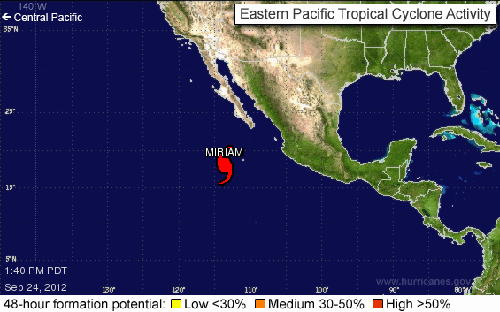
HURRICANE WATCH: Monday, Sept. 24th
Hurricane Miriam has become a Category 3 Major Hurricane and the path continues to curve to the east, now threatening a tropical storm landfall next weekend near San Ignacio on the western side of Baja California Sur
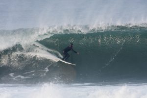
By Tuesday morning it looks like we’ll finally see some legitimate energy out of the NW. This swell will come down the line at a liberal angle of 285-295 degrees with fairly long intervals. The top West facing breaks should go shoulder to head high plus and give us some idea if we have any sandbars or not.
In addition we’ll see some smaller, less consistent swell out of the South. That will be good for knee to waist high plus sets when they do roll through.
Tuesday
2012-09-25 01:01 AM PDT 0.05 feet Low
2012-09-25 07:35 AM PDT 4.48 feet High
2012-09-25 01:05 PM PDT 1.90 feet Low
2012-09-25 07:02 PM PDT 5.32 feet High
The conditions will be fair with variable winds out of the East in the 1-4 MPH zone until 11AM and afternoon onshores up into the 8-10 MPH range. Look for a high
air temp of 71 degrees.
Wednesday morning should still be pretty fun for the better West facing breaks as the swell slows down a hair but will cough up chest to shoulder high sets.
There’s also a chance we may see some steeply angled South swells from what is now TS Mariam, but we’ll have to waist and see on that one.
Wednesday
2012-09-26 01:44 AM PDT 0.02 feet Low
2012-09-26 08:09 AM PDT 4.84 feet High
2012-09-26 01:53 PM PDT 1.39 feet Low
2012-09-26 07:53 PM PDT 5.37 feet High
The conditions will be fair with variable winds in the 1-2 MPH zone until 10AM and afternoon onshores up into the 8-12 MPH range. Look for a high
air temp of 71 degrees.
Thursday morning will see remnant energy out of the NW in the knee to waist high range and some small, but potent, 16 second interval energy out of the SW from an angle 210 degrees. The top spots should pull in waist high plus lines.
We could also see some swell from Hurricane Mariam move in, but I’ll have more on that for tomorrows forecast.
Thursday
2012-09-27 02:20 AM PDT 0.12 feet Low
2012-09-27 08:38 AM PDT 5.13 feet High
2012-09-27 02:35 PM PDT 0.95 feet Low
2012-09-27 08:38 PM PDT 5.32 feet High
The conditions will be fair with variable winds in the 1-3 MPH zone until 11AM and afternoon onshores up into the 8-10 MPH range. Look for a high
air temp of 73 degrees.
The current water temps are as follows – Newport 66 degrees, Huntington 65 degrees, the South Bay showed as 69 degrees, Santa Monica 68 degrees and Malibu 65 degrees.
I’ll be back on Tuesday with the 5DAY 4CAST.


